The Koshi River, one of the most important transboundary rivers in South Asia, originates in the central Himalayas in the Tibet Autonomous Region of China and flows through China, Nepal and India. The river basin, however, faces a number of natural hazards including glacial lake outburst floods (GLOF), landslides and debris flow, which have caused severe social and economic damage in the past years. In 2013, the Institute of Mountain Hazards and Environment (IMHE), Chinese Academy of Sciences, along with the International Centre for Integrated Mountain Development (ICIMOD), launched the Koshi Basin Project (‘Water management and hazard risk reduction related policy and institutional analysis in China for the Koshi River basin management’) as part of the Koshi Basin Programme (KBP), which is jointly implemented by China, India and Nepal with support from the Australian Government through its Sustainable Development Investment Portfolio for South Asia. The project aims to improve research on water-related hazards, ecological and environmental changes and regional economic development in the context of global climate change in the Koshi River basin.
From 9-18June 2014, Dr CHEN Ningsheng and Dr FANG Yiping, along with six other project team members from IMHE, conducted a joint field survey with ICIMOD in Nepal and China. They examined the current status of the Koshi River basin, in particular the distribution of water-induced hazards in the upstream, land and water resources use, and regional economic development.
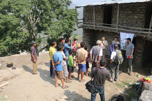
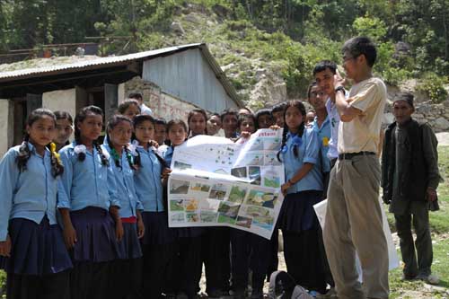
With support from the Central Department of Geography at Tribhuvan University (TU) in Kathmandu, on 10 June the team began examining debris flow and landslide distribution characteristics along the road from Kathmandu to Bhirkot in the central region of Nepal. The team has chosen the Bhirkot community for a case study of mountain hazards and development at the local level. They inspected and analysed two debris flow gullies, AdheriKhola and KukhureKhola, where massive debris flows caused huge damage to a local school and clinic on 15 August 2013. The team met local villagers and gave them advice on hazard risks reduction management. In Bhirkot, the team interviewed local people about education and medical services in the area and discussed the impact of climate change on local agricultural production. The team also shared interactive knowledge with local farmers and students on hazard prevention, monitoring and warning, and trained a local teacher as a liaison person for future hazard risks prevention. Later, the team travelled to the upstream region of the Koshi River basin in China (Tingri and Nyalam Counties) through Zhangmu, the border town between China and Nepal, to investigate water-induced hazard and regional economic development in the area.
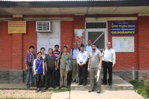
At the beginning of the event, researchers of IMHE visited the Central Department of Geography at Tribhuvan University, where Dr CHEN Ningsheng made a presentation on water-induced hazard distribution characteristics, hazard management strategies and community-based monitoring and warning systems in the Koshi River basin. The team also visited the newly established Sino-Nepal Joint Research Centre for Geography at the university.
After the field survey, Dr CHEN Ningsheng travelled to Kunming to attend the China-ICIMOD Day, where he briefed the participants from across China about the progress of the Koshi Basin Project.

Photo 1: Sharing knowledge about hazard risks prevention and monitoring with local villagers (By IMHE)

Photo 2: Sharing knowledge about hazard risks prevention and monitoring with local students (By IMHE)

Photo 3: The team visits ICIMOD’s HKH-HYCOS Hydrological station in Barabise, Nepal (By IMHE)

Photo 4: The team visits the Central Department of Geography at Tribhuvan University (TU) (By IMHE)
