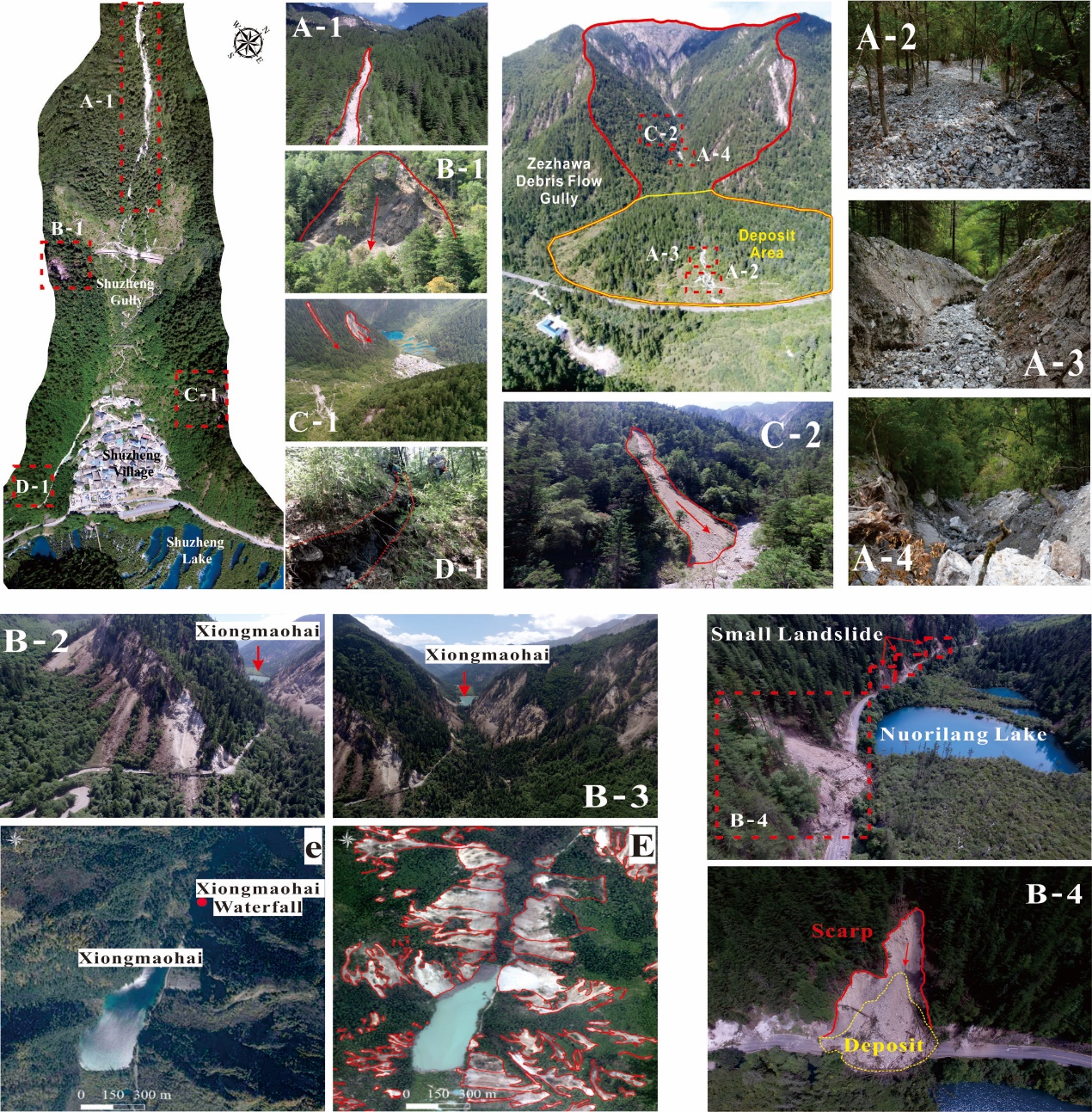
On August 8, 2017, an Ms 7.0 earthquake occurred at the Jiuzhaigou World Natural and Cultural Heritage, Sichuan Province, southwestern China (33.20°N, 103.82°E, focal depth 20 km). More than 1,000 slope failures caused by the earthquake produce a great amount of sediment for debris-flow formation, and hence increase the debris flow risk. How to evaluate accurately post-earthquake debris-flow risk is challenging task and very important for post-earthquake reconstruction when there is no long-term observation data. Until now, there are few approaches of debris-flow risk assessment considering the earthquake-induce landslide sediment. In order to clarify the influence of the increased sediment supply on debris flows, Prof. HU Kaiheng and his team carried on detailed field survey and made significant progress on this problem.
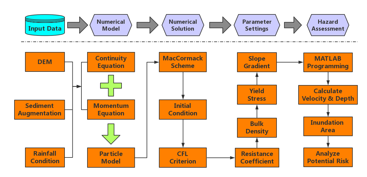
The team identified eighty-three earthquake-induced landslides that directly damaged the Jiuzhaigou heritage sites by combining remote-sensing interpretation and field survey. The coseismic landslides were concentrated primarily within 3 km of the seismogenic fault. Large volumes of sediments were transported into catchments of the Jiuzhaigou Valley, creating a geo-environment conducive to debris flow hazards triggered by post-earthquake heavy rainfall. A methodology combining the calculation of sediment augmentation, particle model, and numerical algorithm is developed to assess the potential danger areas of post-quake debris flows. Five typical catchments strongly affected by the earthquake are chosen as study cases. Debris-flow magnitude, runout distance, flooding extension, and deposition thickness were estimated for the five catchments. The simulation results at Xiajijiehai catchment show a good agreement with the actual inundation area of one post-quake debris-flow event. The comparison of pre- and post-earthquake scenarios shows that an increase in sediment supply can greatly increase the debris-flow potential danger characterized by higher maximum flow depths and larger inundation areas. The risk assessment results are fundamental for post-quake land-use plan and hazard mitigation in the Jiuzhaigou Valley.
Contact:
Prof. HU Kaiheng
Institute of Mountain Hazards and Environment, Chinese Academy of Sciences
Chengdu, Sichuan, 610041, China
Tel: 86-13060064131
E-mail: khhu@imde.ac.cn