This study used machine learning techniques and various factors to clarify flood-susceptible areas in the northeast region of Bangladesh. The results demonstrated that anthropogenic activities such as rapid LCC led to more frequent and severe flooding, and climate change may worsen the situation. Therefore, sophisticated techniques are required to determine areas that are more susceptible to flooding. Of the three standalone and four ensemble models, BRBP-CART-EBF (EM4) yielded the highest AUC values (AUC > 90% in the training and testing stages) for the three flood events evaluated (2000, 2014, and 2017). Thus, the flood maps produced from EM4 were considered accurate for delineating of areas that were susceptible to floods.
Furthermore, LCC that occurred in the downstream portion of the monitoring area was associated with changes in flooding areas between 2000 and 2017. In addition, flooding increases as RD and population increase. More specifically, a considerable decrease in waterbodies (+11.53% with SLCDI = 0.858%) and agricultural land (+25.94% with SLCDI = 0.90%) was observed, mostly due to rapid urbanization and population growth. This resulted in a decrease in the floodplain and disruption of floodwater by infrastructural development, resulting in greater flood susceptibility.
This work was supported by the National Natural Science Foundation of China (Grant no. 41861134008), the Second Tibetan Plateau Scientific Expedition and Research Program (STEP) of China (Grant no. 2019QZKK0902), the National Key Research and Development Program of China (Project no. 2018YFC1505202), and the Key R&D Projects of Sichuan Science and Technology (Grant no. 18ZDYF0329). The research titled Flooding and its relationship with land cover change, population growth, and road density has been published online in Geoscience Frontiers (https://www.sciencedirect.com/science/article/pii/S1674987121000888).
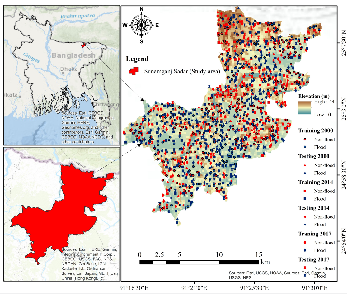
Figure 1. Location of the study area with flood inventory (Image by Mahfuzur Rahman).
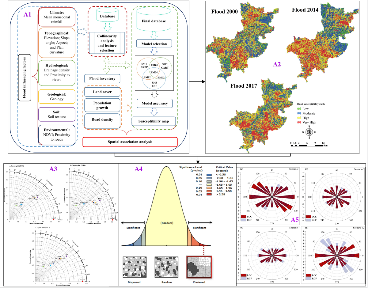
Figure 2. Anthropogenic influences to flood hazards: (A1) workflow of this study, (A2) flood susceptibility maps of the study area via ensemble modeling (BRBP-CART-EBF) between 2000 and 2017, (A3) Taylor diagram showing model performance, (A4) distribution of spatial correlation and significance levels of anthropogenic factors, and (A5) Rose diagram, showing land cover change and relative change of flooding area (Image by Mahfuzur Rahman).
Contact:
Prof. CHEN Ningsheng
Institute of Mountain Hazards and Environment, Chinese Academy of Sciences
Chengdu, Sichuan, 610041, China
Tel: 86-13808171963
E-mail: chennsh@imde.ac.cn