This study performs flood hazard mapping and evaluates community flood coping strategies. In addition, it proposes a humanitarian aid information system (HAIS) to enhance emergency support for flood victims. First, a flood hazard map was prepared using the hydrodynamic model (HM)–FLO 2D coupled with a machine learning algorithm (MLA)-scaled conjugate gradient neural network (SCG-NN). Second, an investigation of local flood management strategies revealed that the current information system is not well prepared for emergencies, including the quantification of emergency relief necessities. Therefore, an HAIS, which specifies hazard information and quantifies emergency aids (food items) for flood victims, can be an effective emergency preparedness tool. We calculated the required emergency aid considering satellite-derived flood data. This study was designed by Prof. CHEN Ningsheng, Dr. Mahfuzur RAHMAN from Institute of Mountain Hazards and Environment, Chinese Academy of Sciences (IMHE, CAS), and Prof. Md Monirul ISLAM from International University of Business Agriculture and Technology (IUBAT), Bangladesh.
To date, a limited number of studies have reported the spatial and dynamic aspects of flooding, especially in developing countries. This study aims to fill this gap in the literature. Accordingly, the implementation of the proposed approach is considered useful for flood hazard modeling. Moreover, in the existing humanitarian assistance scheme, there is hardly any reliable way to calculate humanitarian needs and administer assistance to flood victims. It is also a very challenging task for the local people in affected communities to determine the number of victims who need emergency aid within a very limited time. The estimation of humanitarian demands would be carried out using the information system of the proposed model, and various humanitarian organizations (GOs and NGOs) participating in emergency operation activities would be able to estimate the humanitarian demands of the affected areas. Relief operation during an emergency depends on the type of disaster and environmental characteristics of a given area. In addition, the amount of relief needed to support the victims is estimated based on the magnitude of a disaster and the socioeconomic conditions of an area. Decision makers must guarantee the emergency aid required for the victims to efficiently manage a crisis. Further, the timely distribution of humanitarian aid can alleviate victims’suffering. However, there are few studies in this area. To effectively support and distribute relief to disaster victims, this study proposes a new approach that can contribute to the area of: (i) computing the required amount of relief materials and their spatial distribution considering both flood frequency and duration, and (ii) determining the demand and supply of reliefs’ advance of the actual event. It is worth noting that the proposed approach is not confined to flood hazards but can be utilized in any other environmental hazard. Hence, this study proposes a method for the effective management of emergencies relevant to pre- and post-flood situations.
We further investigated the flood coping strategies at the local level, considering a household survey among 100 households in flood-affected areas. The findings revealed that approximately 53% of the respondents were impacted by a loss of earnings after the flood event. Sixty-seven % of the respondents claimed that they did not have access to weather forecasting information and were vulnerable to potential floods. In addition, around 70% of the respondents claimed that they did not get enough relief items during the 2020 floods from GOs and NGOs. Hence, a novel approach is required for effective flood risk management in the study area and we conclude that the proposed HAIS will help humanitarian organizations and government agencies coordinate and perform relief operations effectively in the worst-hit regions across the country.
This work was supported by the National Natural Science Foundation of China (Grant no. 41861134008), the Second Tibetan Plateau Scientific Expedition and Research Program (STEP) of China (Grant no. 2019QZKK0902), the National Key Research and Development Program of China (Project no. 2018YFC1505202), and the Key R&D Projects of Sichuan Science and Technology (Grant no. 18ZDYF0329). The research titled “Development of flood hazard map and emergency relief operation system using hydrodynamic modeling and machine learning algorithm” has been published online in Journal of Cleaner Production (Q1, IF=7.246)
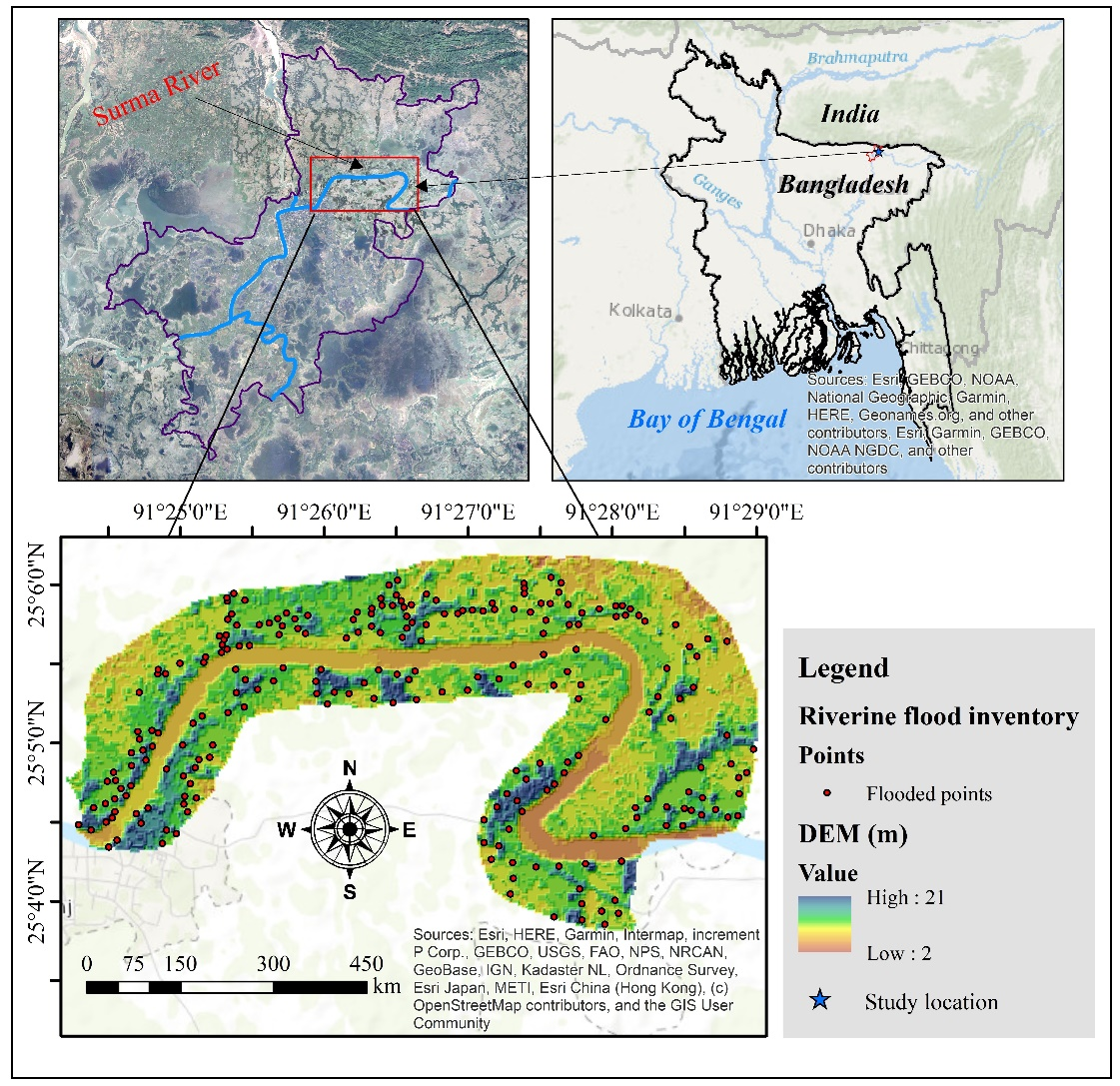
Fig. 1 Location of the study area with flood inventory (Image by Dr. Mahfuzur RAHMAN).

Fig. 2 The workflow of this study (Image by Dr. Mahfuzur RAHMAN).
Contact:
Prof. CHEN Ningsheng
Institute of Mountain Hazards and Environment, Chinese Academy of Sciences
Chengdu, Sichuan, 610041, China
Tel: 86-13808171963
E-mail: chennsh@imde.ac.cn