Landslide-induced surges are common secondary disasters in high- and steep-slope areas, such as reservoirs, river courses, and fjords. Compared to the landslide itself, surges travel farther and affect a much wider area. They often generate destructive wave heights within seconds to tens of seconds of the landslide, posing a serious threat to dams, coastal infrastructure, and human safety. In recent years, chain disasters involving landslide river blocking, impulse wave generation, and breaching have occurred multiple times in the basins of China's Jinsha and Yarlung Tsangpo River basins. Traditional numerical simulation methods face two major bottlenecks: first, the coupling of multiphase media is complex, requiring separate constitutive equations and contact algorithms for the landslide mass (solid phase), water (liquid phase), and wave-mitigating structures (solid boundaries), which leads to high computational costs and susceptibility to numerical instability; second, rapid evaluation of engineering protection schemes is difficult, as the optimal layout positions and parameters of structures such as wave-mitigating piles and energy-dissipating blocks cannot be efficiently traversed through physical experiments, while numerical simulations are limited to comparing only a few schemes due to high computational demands.
To address the above problems, Professor Wu Yong, from the team led by He Siming from the Institute of Mountain Hazards and Environment, Chinese Academy of Sciences, published a study in the Journal of Hydrology. They proposed a unified "everything as fluid" simulation framework that treats the landslide mass, water, and wave-mitigating structures as a single "generalized fluid," distinguishing the mechanical behavior of different media only through an adjustable "solid-phase coefficient." This approach significantly reduces the complexity of handling multiphase interfaces, enabling high-resolution simulation of the entire landslide-impulse wave-mitigation process at the scale of hundreds of cubic meters on an ordinary workstation.
The results show that arranging wave-mitigating piles on the shore side where the landslide enters the water (Scheme A) yields the best performance, reducing the maximum wave height by 64.7% and effectively controlling the leading wave, lowering it from 1.9 m to 0.67 m. In contrast, the reduction rates are only 31.2% and 42.5% when the piles are placed on the opposite bank or in the middle of the water body, respectively. In reproducing the Bageduzhai landslide, the simulation results agreed with the measured data to within 87% (R²). The model also successfully identified an unstable rock mass of approximately 450,000 m³ at the rear scarp, predicting that a secondary slide would generate an impulse wave of about 1.3 m, a prediction later verified by geological radar surveys. Compared with traditional coupled models, this unified fluid model increases computational speed by approximately 5.8 times and eliminates the need for separate meshing or contact definitions, greatly reducing the operational threshold. Based on this research, a specific mitigation recommendation of "submerged pile groups on the landslide entry shore" was proposed and has been implemented in small-scale field trials in a hydropower project area in western China.
The National Natural Science Foundation of China, Sichuan Provincial Guiding Local Projects, and other funding sources supported the above achievements. The findings were published in the Journal of Hydrology.
Link: https://doi.org/10.1016/j.jhydrol.2026.134944
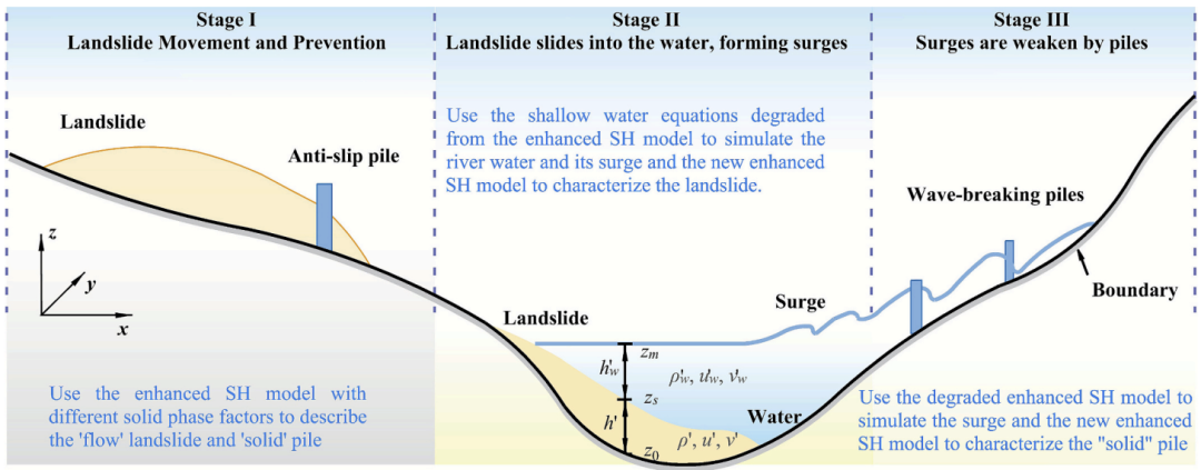
Fig. 1 Schematic of application of the enhanced SH model and its improved ‘flow-flow’ model for landslide, inducing surges, and prevention. (Image by HE Siming' team)
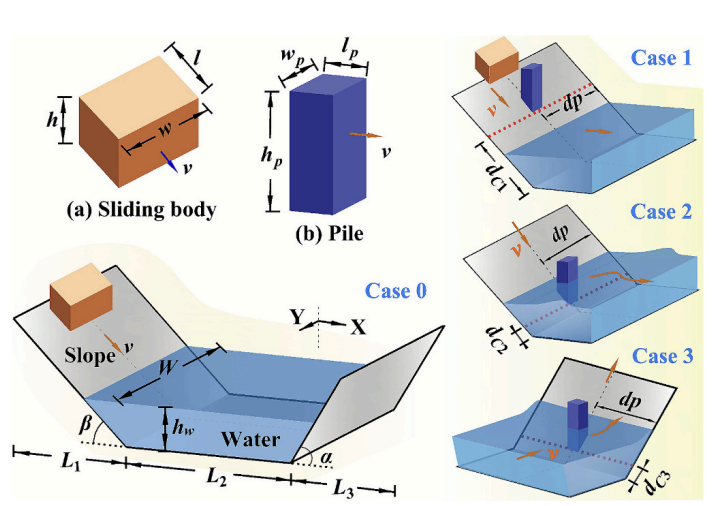
Fig. 2 Simulation model of landslide-induced surges with or without control by pile.(Image by HE Siming' team)
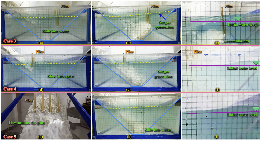
Fig. 3 Experimental effect of single-row piles arranged in various positions on weakening surge.(Image by HE Siming' team)