
Accurate 3D forest reconstruction is essential for quantifying biophysical processes and ecosystem functions. However, the limited spatial coverage of LiDAR systems constrains the generation of structurally detailed forest scenes over large landscapes, while stereoscopic imagery (SI), despite its extensive coverage advantage, cannot penetrate the canopy to acquire the complete canopy structure. Therefore, neither can independently achieve the large-scale and high-precision generation of mountain forest scenes. To address this challenge, the research team on Mountain Quantitative Remote Sensing and Digital Twin at the Institute of Mountain Hazards and Environment, Chinese Academy of Sciences (IMHE, CAS), relying on the Wanglang Mountain Remote Sensing Observation and Research Station of Sichuan Province, proposed a scalable data-fusion framework, successfully achieving the fine reconstruction of large-scale realistic 3D mountain forest scenes.
The research team innovatively integrated the extensive coverage of SI with the high-fidelity vertical structure of unmanned aerial vehicle laser scanning (ULS). This method utilizes structural attributes extracted from SI to scale and rotate ULS-derived single-tree templates. To ensure structural realism, topographic variables including elevation, slope, and aspect were incorporated as strict constraints during the template matching process. Based on the generated fused point clouds, the research team successfully constructed and validated voxel-based 3D forest scenes across 500 m × 500 m coniferous and broadleaf typical plots.
The results demonstrated that the simulated scenes exhibited high vertical structural consistency with the ULS benchmark data. The research further revealed that incorporating topographic constraints effectively compensated for the defects of traditional purely geometric matching, significantly improving structural fidelity. Taking the red band of the coniferous forest as an example, the introduction of topographic constraints drastically reduced the relative deviation of bidirectional reflectance factor (BRF) simulations from 25.87% to 3.01%, fully confirming the necessity of topography-aware modeling in complex mountainous ecological simulations. Combined with the LESS radiative transfer model, the simulation results showed that the radiative transfer characteristics of these 3D scenes were highly consistent with Sentinel-2 satellite observations. This data-fusion approach breaks through the bottleneck of traditional large-scale reconstruction and substantially reduces costs. By digitally expressing complex mountainous vegetation morphology with high fidelity, this research not only supports the fine-scale monitoring of terrestrial ecosystems, but also provides a crucial 3D benchmark and an applicable technological paradigm for constructing digital twin platforms and simulating ecological processes
The research was published in the TOP journal International Journal of Digital Earth under the title "A simple method for large-scale realistic mountain forest scenes reconstruction using visible stereoscopic imagery combined with unmanned aerial vehicle laser scanning data". LIN iaohan, a doctoral candidate at IMHE, and Professor LI Ainong are the co-first authors of the paper. This research was supported by the National Natural Science Foundation of China (U23A2019, W2412146, 42271398) and the National Key Research and Development Program of China (2020YFA0608702).
Paper link:https://www.tandfonline.com/doi/full/10.1080/17538947.2026.2712011
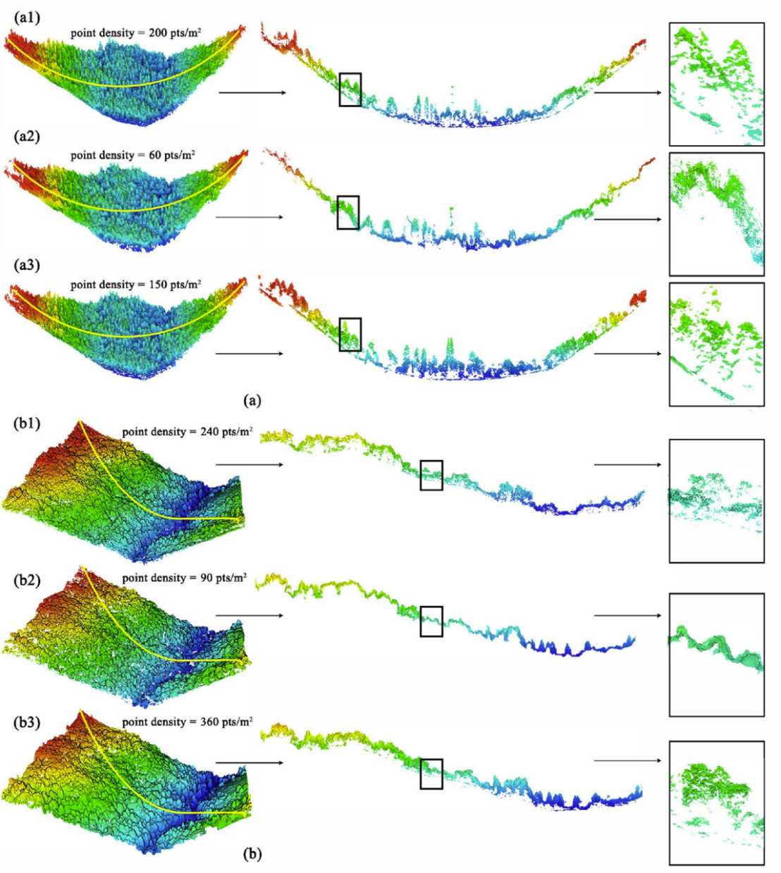
Comparison of ULS, SI, and generated point clouds in coniferous and broadleaf forests (Image by LI et al.,)
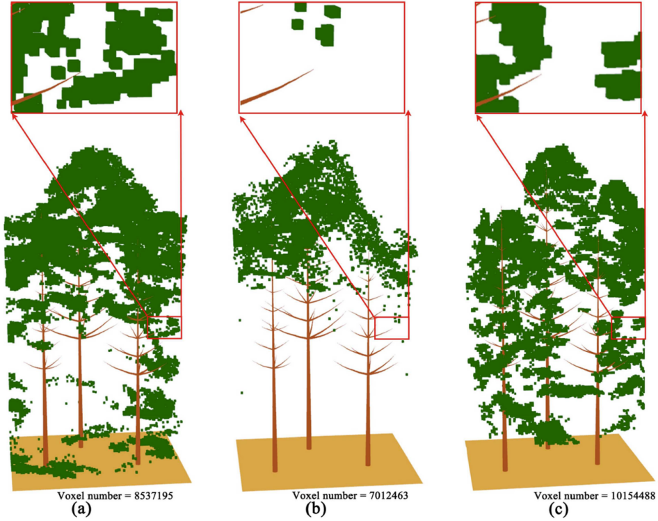
Local coniferous forest scenes reconstructed from ULS, SI, and generated point clouds (Image by LI et al.,)
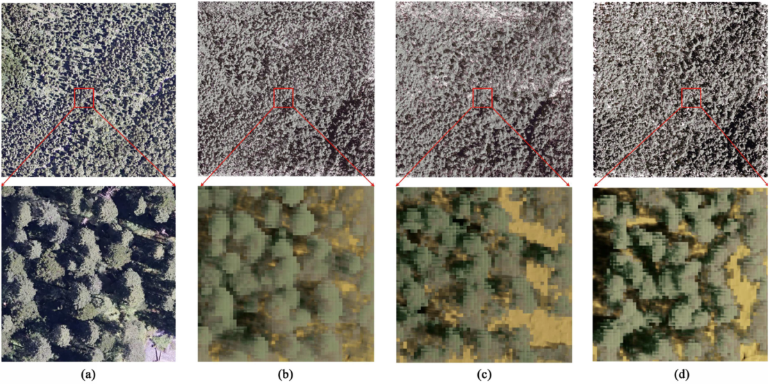
Comparison of the real UAV image with simulated images using ULS, SI, and generated point cloud reconstructed scenes in the coniferous forest (Image by LI et al.,)
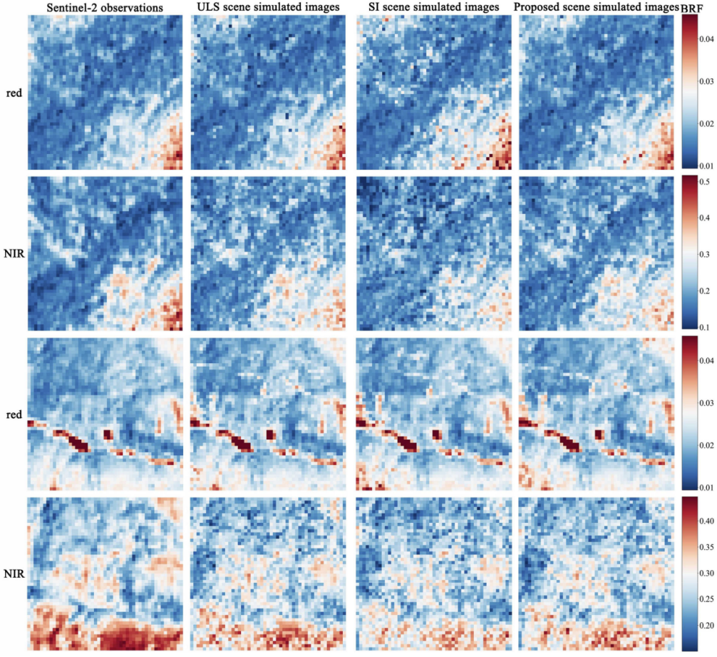
Comparison of Sentinel-2 observations and BRF simulations for various 3D scenes (Image by LI et al.,)